- Air Homepage
- Upper Atmosphere
- Weather Inversions
Stable air and weather inversions
Search for more about meteorology.
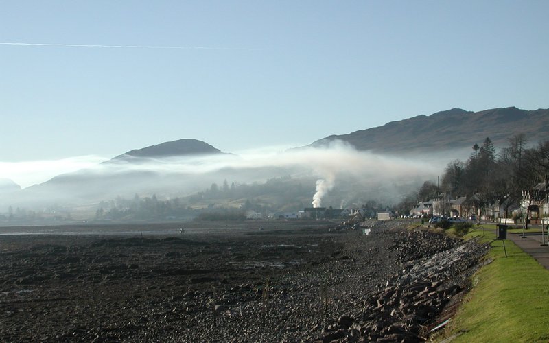
What's the difference between weather inversions and normal weather? A low ceiling from an inversion can trap smoke and other pollutants.
As you go higher, the temperature usually drops, and if it drops suddenly, you've got unstable air. Is it ever going up? It happens more often than you think. We call that an inversion.
The atmosphere is quite stable even if the temperature slowly drops. Mixing isn't its thing in this case. The condition is called isothermal if the temperature doesn't change with height and it's even more stable. If the temperature increases, though, then it's very stable.
Weather inversions can give forecasters a good idea of what's going on. What types and conditions of temperature inversions are there?
If your weather balloon goes up through a layer where the temperature, humidity, and wind direction change, it probably crosses a front and enters a new air mass soon. As a result, we have a frontal inversion, our first type.
What's an air mass? A giant glob of air that all came from the same place, more or less. Maybe it's from the ocean, the arctic or the desert. Masses that are warmer and wetter ride over cooler and drier ones. Air rises when it's hot. That's why weather inversions happen.
The temperature may go up with height when this happens, but not always. Humidity works the same way. However, the wet-bulb potential temperature definitely goes up. It stays the same, more or less, for an air mass that goes over mountains or rains a lot.
Wet bulb potential temperature measures the thermodynamic state of the atmosphere by combining temperature and humidity. A useful parameter for studying atmospheric stability and analyzing weather.
Understanding wet bulb potential temperature starts with understanding wet bulb temperature. A wet bulb temperature is the temperature recorded by a thermometer covered in a wet cloth or wick, which allows for evaporation and gives a lower reading than a dry bulb temperature. A wet bulb temperature takes into account evaporative cooling caused by moisture evaporating from the thermometer without a change in pressure.
A thermodynamic process called potential temperature adjusts the wet bulb temperature to a reference pressure level. An air parcel's potential temperature is what it'd be if it were brought to a standard pressure level adiabatically (without losing or gaining heat).
Meteorologists can assess the stability of the atmosphere by calculating the wet bulb potential temperature at various heights. A higher wet bulb potential temperature at low elevations indicates an unstable atmosphere, while a lower value suggests a more stable atmosphere.
Wet bulb potential temperature is particularly useful for forecasting severe weather events like thunderstorms and convective storms. Meteorologists use it to estimate the amount of energy available for convection during strong updrafts and severe weather.
Basically, this convenient number, wet bulb potential temperature combines temperature, humidity, and atmospheric pressure to provide insights into the stability and thermodynamic state of the atmosphere, especially during severe weather.
Here's another situation leading to inversion:
Cool night, no clouds, no wind. So what happens? Radiation from the ground sends heat into space. Radiation from long waves (infrared). It takes a lot of energy, and the dirt gets cold fast.
Then it robs the lowest air layer (planetary boundary layer) of its heat, making it colder. That's it! We now have a radiation inversion.
This kind of thing gets slowed down by clouds. Inversions can't form well in a breeze because wind stirs up the air. Inversions are stronger during long nights like those found in winter because they have more time to develop.
If the relative humidity is high enough before cooling, fog, dew or frost can form. This is a diabatic process, which is the opposite of adiabatic.
Here's another type of inversion? Air moves downward in a HIGH pressure system. That's why there's less cloud. Due to compression, the pressure increases closer to earth and the air warms up.
Afterwards, the air dries out and becomes more stable, so it's warmer than below. Because the fastest verticalmotions (both up and down) happens thousands of feet above ground.
A subsidence inversion occurs and is the opposite of what happens a LOW, which destabilizes rising air. Surface temperatures can rise, increasing the frequency and intensity of extreme weather events such as heat waves and droughts.
When warm air moves horizontally, it's called warm air advection. As a result, warm air gets trapped slightly above the ground, creating a temperature inversion that keeps the air below from rising and cooling off. In this case, air quality often drops and health risks increase.
Turbulence inversions, also known as low-level temperature inversions, are layers of stable air that form above the surface and create a barrier to vertical movement of air. They may be found a few thousand feet off the ground, have little or no cloud, and don't affect people on the ground.
In aviation, these mechanisms, among others, may lead to increased turbulence and potentially hazardous conditions. These inversions are closely monitored by meteorologists and pilots in order to assess the potential for turbulence and plan accordingly.
#38
Search this site for more information now.
Among all weather inversions, this is the largest
It's called the tropopause. It's the boundary between the top of the troposphere and the bottom of the stratosphere. The tropopause is defined as:
"The lowest level in the layer from the surface up to an including the 30 mb level at which the lapse rate (rate of temperature drop) decreases to 2°C/km, or less, provided the average lapse rate between this level and all higher levels within two kilometers doesn't exceed 2°C/km." It can happen at multiple levels at the same time.
A lapse of two degrees per kilometer isn't an inversion, but it's still stable air. There's one big inversion in the stratosphere. It's miles deep.
Here are a few other mechanisms for inversion creation:
Cold air flows like water, but slower. It makes "rivers" and "lakes" because it's heavy and stays near the bottom. Air that's dry flows the same way. We call this a Katabatic flow.
Inversions also happen when frigid arctic air flows southward under warmer air and pushes it upwards. This is a Continental Arctic Air Inversion.
Low level weather inversions also occur when warm air passes over a cold surface. This is a marine inversion.
Bet you didn't know there could be so much said about clearing skies. Go back from Weather Inversions to the
Chasing Storms web page.
Search this site for more information now.
Inversions of the atmosphere: Do You Enjoy Calm, Dry Weather?
What are the conditions associated with inversions in the air? Why do they occur? Read on for a brief overview.
Do you have concerns about air pollution in your area??
Perhaps modelling air pollution will provide the answers to your question.
That is what I do on a full-time basis. Find out if it is necessary for your project.
Have your Say...
on the StuffintheAir facebook page
Other topics listed in these guides:
The Stuff in the Air Site Map
And,
Thank you to my research and writing assistants, ChatGPT and WordTune, as well as Wombo and others for the images.
GPT-4, OpenAI's large-scale language generation model, helped generate this text. As soon as draft language is generated, the author reviews, edits, and revises it to their own liking and is responsible for the content.


New! Comments
Do you like what you see here? Please let us know in the box below.