- Air Homepage
- Weather Maps
- Weather Jet Streams
Buys-Ballot Law, weather jet streams, and the relationship between Pressure and Wind.
What makes weather jet streams? How do jet streams affect our weather forecasts? Ground-level winds must be affected by wind in the upper atmosphere. How do airport wind socks work?
Search for more weather info.
How the Jet Stream is Created by Pressure and Coriolis - An old meteorological law can tell you where the low pressure center is and how strong the wind will be higher up just by knowing the direction of the wind? Learn how the Earth's rotation and a simple pressure gradient create the fast-moving river of air known as the jet stream that steers all our weather instead of just checking the wind speed.

Why would find jet streams and their connection to basic upper level winds interesting?
- The study of these wind patterns helps us gain a better understanding of how different factors in the atmosphere influence the weather. As a result, they will be able to make connections between wind patterns and weather phenomena such as storms, cloud formation, or temperature changes.
- People who are fascinated by airplanes and aviation may find the concept of jet streams interesting. An understanding of how jet streams influence flight paths, travel times, and air travel can spark our interest in aviation.
- The knowledge of wind patterns can enhance outdoor activities such as kite flying, sailing, and wind sports. Our children can learn how to anticipate wind conditions, identify wind directions, and utilize wind patterns for recreational purposes.
- The study of geostrophic winds, gradient winds, and jet streams, outlined below, can foster an interest in scientific inquiry and exploration. There is the possibility that students will be inspired to learn more about meteorology, atmospheric science, and the broader field of Earth sciences.
- We all can gain a better understanding of real-life applications by exploring these wind patterns. It may be instructive to learn how weather forecasting relies on an understanding of wind patterns, or how wind energy is utilized to generate electricity.
Developing critical thinking skills and problem-solving abilities is essential to understanding wind patterns. Meteorologists analyze weather maps, interpret wind data, and make predictions using their knowledge of wind patterns.

Geostrophic relationships and the Buys-Ballot Law
The Buys-Ballot law explains how pressure, temperature, and jet streams are related in two parts:
A) As you move horizontally, the more suddenly the air pressure changes, the stronger the wind. The strength of the pressure gradient (the line pointing from highest to lowest pressure) is directly proportional to the wind speed, so we have a geostrophic relationship. It's an ideal, frictionless situation. It's almost like that up there in the higher elevations. Jet stream winds that blow from west to east can be explained by the air pressure gradient in the troposphere.
 Atmospheric circulation
The strength of the relationship depends on how far north you are. Technically, this is due to a change in the Coriolis parameter, which is proportional to the latitude's trigonometric sine.
B) If you look horizontally in the direction of the greatest pressure decrease, the wind will come from your left. In the direction of the low.
Some info on geostrophic winds and forecasting. A "Geostrophic Wind Scale" is an analog forecasting ruler that meteorologists used at one time for a quick estimate. These tools were used locally, by specific meteorological organizations. In general, though, it's best to consult meteorological textbooks, research papers, or meteorologists directly for a comprehensive understanding. The scale incorporated the following theory to give a convenient assessment.
Winds that result from a balance between pressure gradients and Coriolis effects are called geostrophic winds. Geostrophic balance means the pressure gradient force, which drives air from high pressure areas to low pressure areas, is exactly balanced by the Coriolis force, which is the deflection of air caused by the Earth's rotation.
Gradient Winds, Geostrophic Winds, and Jet Streams
Wind patterns and atmospheric circulation are described by geostrophic winds, gradient winds, and jet streams in meteorology. I'll go into this a bit further.
We started with geostrophic winds, horizontal winds resulting from a balance between pressure gradients and Coriolis forces. Pressure gradients push air from high pressure areas to low pressure areas in the Northern Hemisphere. Meanwhile, the Coriolis effect, caused by the Earth's rotation, appears to deflect moving air to the right (when viewed from the perspective of someone on the earth). Geostrophic winds blow parallel to isobars (lines of equal pressure) when these two forces are balanced. Most geostrophic winds are in the upper levels of the atmosphere, and they're usually stronger than surface winds.

Gradient winds blow around curved isobars instead of straight isobars the way geostrophic winds do. Gradient winds happen when the pressure gradient force isn't in perfect balance with the Coriolis effect. In the lower levels of the atmosphere, gradient winds are caused by friction with the Earth's surface increase curvature in the isobars. In high or low pressure regions, they're important for understanding wind patterns and deviations from theoretical ideals near the surface.
Jet streams are fast-moving, narrow air currents in the upper atmosphere. These strong horizontal winds travel in meandering paths, generally from west to east. Jet streams are driven by a combination of things, including the temperature gradient between equatorial and polar regions, the rotation of the earth, and atmospheric pressure patterns. Wind speeds can exceed 100 knots (115 mph) in the upper troposphere and lower stratosphere. Weather patterns, air travel, and the movement of weather systems are heavily influenced by jet streams.
Both of these concepts affect the overall circulation and dynamics of the atmosphere. Gradient winds and geostrophic winds describe different wind patterns at different levels of the atmosphere, with geostrophic winds dominating in the upper levels and gradient winds near the surface. Surface weather systems can be affected by the jet stream, which is a really manifestation of geostrophic winds.
Current weather jet streams
When we analyze jet streams that are always high up in the atmosphere, we mark the middle of a core of high winds resulting from the Buys Ballot Law with a "J". The jet stream is identified by this.

Aviation wind socks and other wind instruments that display both wind speed and direction can show erratic motion when jets are low in altitude. By the way, the socks let people on the airfield know what the wind's like in a qualitative fashion. Regardless of the wind's cause, they show surface wind speed, direction, and turbulence.
Jet stream flows usually happen at around 30,000 feet or higher. Synoptic and mesoscale weather systems are pushed along the jet's flow direction by the jet stream.

#25
Overall, geostrophic winds, gradient winds, and jet streams provide a fascinating insight into the workings of the atmosphere. Understanding these concepts can foster curiosity, scientific thinking, and a greater appreciation for the natural world, weather, and climate.
It's important for meteorologists to understand how these flows interact to analyze weather patterns, forecast, and understand atmospheric dynamics.
Search this site for more information now. For further details, read about upper air analysis Go back from Weather Jet Streams to the Forecast Map Weather web page or visit the Stuff in the Air homepage.
Recent Articles
-
Global Warming Klan
May 15, 26 12:57 AM
 Planet Rescue: Real Action or Total Chaos? - Some people are so worried about the world that they come up with some pretty crazy ideas. Discover how kids
 -
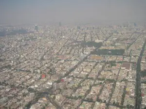
What causes pollution in the outside?
May 12, 26 12:44 AM
 The Hidden World of Pollution - Does the air you breathe have anything to do with a distant volcano or a dusty farm field? There's more to the gray haze
 -
UNDERWEAR AND POLLUTION
May 11, 26 12:12 AM
 Can Underwear Save the Earth? - What if your favorite pair of underwear were the only thing stopping a climate catastrophe? The hilarious truth about farts,
What kind of weather can be expected in your area, based on current weather jet streams?
The type of weather jet streams bring us, the measurement of wind, and the creation of wind.
Do you have concerns about air pollution in your area??
Perhaps modelling air pollution will provide the answers to your question.
That is what I do on a full-time basis. Find out if it is necessary for your project.
Have your Say...
on the StuffintheAir facebook page
Other topics listed in these guides:
The Stuff-in-the-Air Site Map
And,
Thank you to my research and writing assistants, ChatGPT and WordTune, as well as Wombo and others for the images.
OpenAI's large-scale language generation model (and others provided by Google and Meta), helped generate this text. As soon as draft language is generated, the author reviews, edits, and revises it to their own liking and is responsible for the content.
By Barry Lough, P.Met., EP (Environmental Professional)
Text copyright © 2003-2024 Stuff in the Air.com
BACK TO TOP - Hit your 'Home' Key
New! Comments
Do you like what you see here? Please let us know in the box below.