- Air Homepage
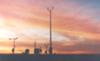
- Satellites
The Secrets of Image Satellite Weather in Meteorology and Space Exploration
An image satellite weather forecasters use during the analysis state? Basically, meteorologists are constantly monitoring satellite data and using it to make forecasts.
Satellites: The Secrets of the Sky - Imagine cameras flying twenty thousand miles above Earth that can take pictures of your whole continent every fifteen minutes or race over the poles for high-resolution closeups! Discover the jaw-dropping technology of geostationary and polar-orbiting satellites that make modern weather predictions possible.
You might be fascinated by weather satellites. We use weather satellites to get real-time data on the Earth's atmosphere so we can predict the weather for the day. Meteorologists use them to make more accurate forecasts and prepare for severe weather.
Why learning about satellites can be fun and interesting
Satellites offer a window into space exploration and our place in the universe. Astronomy, astrophysics, and the wonders of our solar system can be explored through satellites. It gives you a chance to learn about satellites, their functions, and how they help with scientific research, weather forecasts, communication, and navigation.
Secondly, studying satellites lets you appreciate the technology and engineering behind them. You might take an interest in rocketry, orbits, remote sensing, and data transmission. STEM (Science, Technology, Engineering, and Mathematics) fields and careers in aerospace engineering, astrophysics, or Earth observation can be influenced by this knowledge.
Last but not least, satellites are part of our everyday lives. We can learn a lot about satellites by examining how they enable global communication, provide weather forecasts, monitor climate change, and support disaster management. If so, you might be captivated by the mysteries of space, fascinated by technology, and eager to explore satellites' scientific and practical applications.
Each specialist needs to process and customize the satellite pictures. What do they make of this satellite imagery?

This image satellite weather technology has been around a while. Over the last 60 years or so, it has become crucial to weather forecasting.
With advancements in technology over the years, the number of possible uses has also increased. We can use one of these satellite images to get planet temperatures, humidity pictures, cloud pictures, and even wind data.
With the derived data, we can identify long-term trends and make short-term weather predictions with a lot more precision. There are a lot of other uses for satellite technology. Satellite pics give us a better perspective on air pollution, for example. Read on for the other type of weather satellites.
Large scale satellite weather photography has become important for pilots flying into areas with sparse surface and radiosonde weather data. Photographs can also give them more of the information they need.
A brief History of Weather Satellites
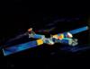
What was the first weather satellite? Tiros-1 was launched in 1960, in the USA. We're now used to a world monitored by five geostationary and four polar-orbiting satellites.
That was brief. But what is Tiros?
TIROS (TV Infra-Red Observation Satellite) comes with cameras and other high-tech weather equipment like radiometers, sounders and data collection systems. High Resolution Picture Transmission (HRPT) images can be quite amazing when viewed on receivers that can see the satellite.
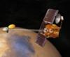
Geostationary - Image Satellite Weather
What does that mean? It is possible to engineer satellites to fly with the perfect combination of acceleration, speed, velocity, and height so that they stay over the same spot on the rotating earth. Geostationary means just that.

For this to work, it has to be over the equator. Due to its high altitude, around around 22,000 miles or 36,000 km, we can get good equator maps and clouds over most of the earth, with the exception of the poles. Keeping its position requires a constant speed nearly 7,000 miles per hour or 11,000 km per hour around the earth's axis.
It's Kind of like a Portable Weather Station...
Every 15 minutes, we get a fresh image satellite weather snapshot with varying energy-frequency-wavelength values. They're great for creating loops and animating satellite photos.
Five geostationary satellites let us see the whole planet between 60°N and 60°S. They linger above the equator at 75°W, 135°W, 140°E, 70°E and about 0°, the prime meridian. And if one of the satellites fails, the others can reposition themselves to compensate until it starts working again.
Each vehicle weighs nearly half a ton and rotates rapidly while the cameras are held steady. They collect energy from sunlight through solar panels. These engineers thought of everything.
Satellite instruments take infrared and visible light photos, plus a bunch of other stuff. Using a telescope on board, we can get high-resolution pictures of the earth.
Data is then sent to the ground through onboard transmitters, where computers overlay geographical maps for easier reference. A satellite then distributes the completed image to forecast centers, TV stations
and whatnot.
Even though it's not perfect, the whole system is pretty reliable. Are you familiar with these systems? I would appreciate if you could inform my readers.
Greatest Weather Forecasts
Know a better place for forecasts? Really cool graphics or outstanding weather information?
All weather people like to find new places for unusual data, and here's your chance to help. Feel free to comment; that would be much appreciated. Thank you.
P.S. This is NOT the Weather Network.
What have the other people said about weather?
Scan here to see contributions from previous visitors to this page...
nowhere 
Well, since ur a weather people person...in Manitoba it's weird; we flood all the time and some days it gets really hot out then the next day its snowing …
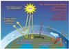
Atmospheric green house effect
See the heating of the planet's surface arising from the blanketing effect of anthropogenic carbon dioxide in the air.
What gases? carbon-dioxide, Nitrous …

I want to see my house to day 5/14/2009
I want to see my house to day on the satellite how I can get help? Murtaza Para
I like this site so much. everyday I watch my city in the map. thanx …
Actual Forecasts for me is Yahoo Weather
I usually prefer yahoo weather forecasts for up to date accurate information in my area.
Yes satellite is definitely an important tool for modern weather …
survelliance through satellite
Satellites play an important role in weather forecasting. These satellites collect images and then the meteorological people forcast the weather for the …
Eyes in the Sky
Weather satellites are a very important tool in the art and science of weather forcasting. Data gathered from satellite images allows meteorologists to …

ARMAGEDDON-WORTHY CLOUDS Not rated yet
I believe it was in the month of February that these Armageddon clouds made their debut over Wright-Patterson Air Force Base, Fairborn OH, and I quickly …
two bright lights in south-east sky Not rated yet
On the night of August 19, 2011 @ 9:45 pm we saw two bright lights, one above the other in the south-east sky. The lower one dimmed & was gone withen …
Forecasting the Future Not rated yet
Although weather predictions are not always accurate and despite the fact there are days where we would all like to strangle the weather person that told …
Complete coverage every day! Not rated yet
We've become accustomed to timely and accurate weather forecasting. Developments in the late 20th Century in imaging and control systems enabled the use …
Local weather Not rated yet
A project at my old elementary school took measurements directly from the roof of the school building and made the information available to the public. …
Sweeping the earth below
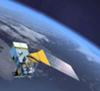
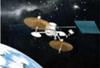
For practical purposes, we have to make a trade-off here. Satellites at high altitude can see a lot of area at once, but their resolution isn't great.
Polar orbiting satellites fly at much lower altitudes and can see much closer. They have to move across the earth to get a broader image satellite weather because their pictures aren't as wide.
These satellites race from the North Pole to South Pole and back in less than two hours, at only 500 miles (800 km) up. Each one then moves over and takes a picture of the next strip of earth, following the meridians like the lines on a pumpkin. And it keeps going with all that speed in a vessel weighing about 3/4 ton.
Each satellite's orbit stays fixed relative to the sun so that it always makes its northbound journey near noon on the ground directly below. This means every location on earth gets its photo at roughly the same time every day. This time-coordinated quality is called sun-synchronous.
The resulting satellite photos look like ribbons stretching around the earth.

#3
As you get closer to the poles, there'll be more overlap. Weather forecasters use the extra data in these regions to make more accurate maps of the South and North Poles.
This increased temporal resolution and frequency gives high-latitude meteorologists good North Pole pictures and usable animations. In these Polar Regions, satellite weather photos are poorer or nonexistent because the geostationary satellites don't cover them.
And now for…
Comparative Analysis - The Big Picture
We can interpret the images and make sense of this meteorological chaos from these two types of satellites.
Geostationary Satellites - Satellite weather pictures and large area pictures taken by geostationary satellites. They're great for animated satellite displays.
Polar
Orbiting Satellites - Better resolution for studying and analyzing detailed photos, especially near polar latitudes, but not for animating them. They're also less expensive.
Recent Articles
-
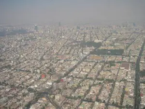
What causes pollution in the outside?
May 12, 26 12:44 AM
 The Hidden World of Pollution - Does the air you breathe have anything to do with a distant volcano or a dusty farm field? There's more to the gray haze
 -
UNDERWEAR AND POLLUTION
May 11, 26 12:12 AM
 Can Underwear Save the Earth? - What if your favorite pair of underwear were the only thing stopping a climate catastrophe? The hilarious truth about farts,
 -
Levi Mays Story about little boys
May 09, 26 07:06 PM
 The Secret History of Hot Air - Ever feel like there's more to what you see on the news? Get your detective gear on because we're diving into a world of
Do you understand what you see when you view satellite weather images?
Satellite weather photos, air maps, and animations can improve your TV broadcast image.
Do you have concerns about air pollution in your area??
Perhaps modelling air pollution will provide the answers to your question.
That is what I do on a full-time basis. Find out if it is necessary for your project.
Have your Say...
on the StuffintheAir facebook page
Other topics listed in these guides:
The Stuff-in-the-Air Site Map
And,
Thank you to my research and writing assistants, ChatGPT and WordTune, as well as Wombo and others for the images.
OpenAI's large-scale language generation model (and others provided by Google and Meta), helped generate this text. As soon as draft language is generated, the author reviews, edits, and revises it to their own liking and is responsible for the content.
You are here:
Most Popular Pages on this Website:
Pictures of Global Warming
- See photos, cartoons, charts, graphs and a few surprises.
Clouds
- Don't know a cumulus from a stratus? Check here.
Causes of Global Warming
- It's not always obvious.
Calgary Alberta Weather
- Example of Canadian Goodness.
Thermometers
- Our favourite weather instrument.
- Home
- Contact Us
- Free E-zine Back Issues
- Privacy Policy
- Site Map - I'll help find something good.
By Barry Lough, P.Met., EP (Environmental Professional)
Text copyright © 2003-2024 Stuff in the Air.com
BACK TO TOP - Hit your 'Home' Key
New! Comments
Do you like what you see here? Please let us know in the box below.