- Air Homepage
- About Us
- Cloud Blowing Wind
Cloud Blowing Wind: Discover the Mysteries!
Search for more about weather.
Busted! The "cloud blowing wind" Myth
Have you ever seen a puffy cloud cartoon with a grumpy face blowing wind? There's more to the story! Here, we debunk this myth and look at the real science behind it.
Find out:
- Wind doesn't blow from clouds,
- Cloud formation and wind,
- Cloud behavior: a fascinating science.
Your newfound cloud knowledge will impress your friends! Need an example of such a wind, anyway?
How about a Föhn wind? - Now...What is that?

Unpacking the Science of Mountain Downslope Winds with Föhn Wind Fury Science is way more powerful than cartoon drawings. Learn about the fascinating science of the Föhn wind, a legendary weather phenomenon that can eat up a foot of snow in an hour!
Imagine the power and energy of the legendary Chinook Winds! Officially, cloud-blowing-wind isn't a meteorological term. Clouds form when water vapor condenses in the atmosphere and are influenced by factors like temperature, humidity, and air currents. Other than cumulonimbus, clouds don't blow wind, though.
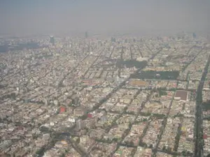
If you're talking about clouds moving due to wind, that's a natural thing. Wind is the horizontal movement of air in the atmosphere, which can cause clouds to drift or move. Clouds move according to the speed and direction of the wind. Such as the example in the photo above.
Föhn wind? - (e.g., Chinook) Some people spell it a foehn wind instead. Winds of this type are basically the same regardless of their geographic location and local name.
Is there anyone passionate about clouds and wind?
People who might be interested in clouds and wind are:
- Meteorologists study weather patterns, including cloud movement. To forecast weather, they analyze atmospheric conditions, including wind patterns.
- Enthusiasts of weather may find the movement of clouds and the interaction with wind fascinating. Observing and understanding clouds, their formations, and how they change and move in response to atmospheric conditions is one of their favorite things.
- Artists and photographers love clouds for their visual appeal (my friend Ray, above, for example). When artists and photographers capture the beauty and unique formations of clouds, they may be interested in the movement of clouds and the interaction with wind.
- People who love to hike, sail, or fly pay attention to cloud movement and wind patterns for safety and planning. Making informed decisions can be easier if they understand how clouds move. This includes kite flyers and drone pilots.
- Researchers and Scientists: In a variety of fields, like atmospheric science, climate research, or renewable energy, researchers and scientists study how clouds move and how wind affects them to get an understanding of atmospheric dynamics, climate patterns, or wind energy.
Discover the unique characteristics of Föhn winds and their clouds.
Why is the downwind side of a mountain range so dry? In other words, downwind from the prevailing wind. An orographic lift pushes moist air up a mountain, and it expands and cools.
 Chinook clouds are fun to watch
Precipitation falls from it and releases latent heat into the air.
The leftover heat changes the expansion's adiabatic properties. The katabatic wind descends the dry side of the mountain ridge and warms up faster than it cooled when it rose upstream. We're left with a strong, warm, dehydrating breeze, perfect for desertification and fires.
Santa Ana Winds are a prime example. Chinook winds in western North America, too.
Other parts of the world, where mountains rise into the sky, give them colourful names like Halny, Viento Sur, and Terral. Residents of the southern hemisphere use words like Zonda, Nor'wester, and Bergwind.
How does it work?
We'll use the example of Chinook winds, which blow down the eastern slopes of the Rocky Mountains in North America. Here's how it goes:
-A high-pressure system forms over the Pacific Ocean, bringing cool, moist air inland.
-Cool air moves eastward as it encounters the Rocky Mountains. When the air rises over the mountains, it cools and loses moisture as precipitation. Orographic lift is what this is.
-As air descends on the eastern side of the mountains, it's compressed by the increased air pressure at lower elevations. Per 1000 meters of descent, the air warms up by about 10°C. This is what we call adiabatic warming.
-Foehn effect: Warm, dry air on the eastern side of the mountains creates a low-pressure system that pulls warm air from the west thus increasing the wind speed. Foehn effect amplifies the warming and drying process.
-Chinook arch: The Chinook wind creates a distinctive cloud formation called the Chinook arch. As the Chinook wind approaches, you can see this cloud formation. See one in the next photo.
How important is wind information to the accuracy of air quality data? Read about it here.
What kind of clouds this cloud blowing wind blows
The breeze moves thick clouds downwind once they're over the lee side of the mountains. Over time, a gap appears between the cover and the horizon on the upwind side. An overhead shield gets a distinctive curved edge from the cloud blowing wind. We call that a chinook arch on the Great Plains, for example. It's awesome to take pictures of them.

Any exceptions?
Due to the dry wind, there aren't a lot of clouds and precipitation is sparse. Most of the sky is covered with the arch and its stratus cloud, but not with thick clouds. Despite what SHOULD be a cloud blowing wind, many clouds don't always move much. For example, thick, quasi-stationary wall clouds can lie upwind.
You can see the beginnings of a good wall cloud in the lower clouds in the picture above. Those higher ones can be cap clouds or downwind lenticular clouds.
What's more, the chinook winds blow through many types of clouds without moving them. For instance, the wind doesn't seem to move atmospheric waves. Mountain lees (i.e., downwind sides) form lenticular clouds. After climbing up the range, the wind races down the other side. It hits the bottom and bounces back up, creating a wave. This is a standing wave, since the air moves, but the wave doesn't. There's a similar wave downstream from a weir in a river.
In this second crest (the first being over the hill itself, where the cap cloud forms), a stationary cloud can form. From the side, it looks like a contact lens because it highlights only the very top of the lee wave. It's narrow at both ends and wide in the middle, but it's curved. Convective clouds form around 7 to 10 thousand feet above sea level. This means they take place in air that's rising faster than the surrounding air.
Put all these facts together and you've got Altocumulus Standing Lenticularis (ACSL). Our cloud blowing wind made this.
Those involved in meteorology, weather enthusiasts, artists, outdoor enthusiasts, researchers, and scientists in related fields might be interested in cloud movement and wind interaction.
Go back from Cloud Blowing Wind to the Weather Equipment web page, or visit the Stuff in the Air homepage.
Search this site for more information now.
Recent Articles
-
What causes pollution in the outside?
May 12, 26 12:44 AM
 The Hidden World of Pollution - Does the air you breathe have anything to do with a distant volcano or a dusty farm field? There's more to the gray haze
 -
UNDERWEAR AND POLLUTION
May 11, 26 12:12 AM
 Can Underwear Save the Earth? - What if your favorite pair of underwear were the only thing stopping a climate catastrophe? The hilarious truth about farts,
 -
Levi Mays Story about little boys
May 09, 26 07:06 PM
 The Secret History of Hot Air - Ever feel like there's more to what you see on the news? Get your detective gear on because we're diving into a world of

What does cloud-blowing wind mean to you?
This label can be applied to any wind that moves clouds. It is true that any wind that occurs when clouds are present can be classified as such. Here is an example of moving air.
Do you have concerns about air pollution in your area??
Perhaps modelling air pollution will provide the answers to your question.
That is what I do on a full-time basis. Find out if it is necessary for your project.
Have your Say...
on the StuffintheAir facebook page
Other topics listed in these guides:
The Stuff-in-the-Air Site Map
And,
Thank you to my research and writing assistants, ChatGPT and WordTune, as well as Wombo and others for the images.
OpenAI's large-scale language generation model (and others provided by Google and Meta), helped generate this text. As soon as draft language is generated, the author reviews, edits, and revises it to their own liking and is responsible for the content.
By Barry Lough, P.Met., EP (Environmental Professional)
Text copyright © 2003-2024 Stuff in the Air.com
BACK TO TOP - Hit your 'Home' Key
New! Comments
Do you like what you see here? Please let us know in the box below.