- Air Homepage
- Upper Atmosphere
- Explain Humidity
Explain Humidity: The Mysteries of this Meteorological Marvel
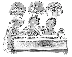
What's so important about water vapour? I'll explain humidity and its effects. The water vapour in the atmosphere helps regulate the planet's temperature. Humidity can make the air uncomfortable, while low humidity can make the air dry and cause respiratory problems.
Find more about meteorology.
Humidity and Storms: The Invisible Fuel - Did you know that water vapor in the air literally fuels thunderstorms and makes you feel hot on a summer day? Discover how atmospheric moisture defines the cloud base and tells forecasters when severe storms will erupt without just checking the relative humidity.
Explore the impacts of Atmospheric Moisture: From Cloud Formation to Summer Storms. Find out how humidity affects temperatures, weather patterns, and even your health.
Find out why the LCL and LFC matter in meteorology. Come along on this meteorological journey and demystify the invisible force that shapes our skies.

What's the best way to measure humidity? Water vapor in the air is usually what determines humidity. We measure humidity with a hygrometer which measures vaporized water in the air.
In saturated air, there's a lot of vapor. When the air is full of water molecules, it can't hold any more. Though we all say it this way, air doesn't actually hold the water. However, the amount of water vapor in the air determines humidity. Water vapor can be calculated by first measuring air temperature and pressure. The air gets "saturated" with water molecules when the temperature and humidity reach a certain point.
Our Weather and Comfort Depend on Humidity
Atmospheric moisture content is measured by relative humidity (RH), mixing ratio (MR), absolute humidity (AH), and vapor pressure (VP). Let's start with relative humidity. At a given temperature and pressure, relative humidity is the ratio between the amount of water vapor present in the air and the maximum amount the air can hold. Percentage is expressed as a number. At 100% relative humidity, the air is completely saturated with water vapor.
Air mixing ratio is the ratio of water vapor to dry air in a given volume. Water vapor per kilogram of dry air is measured in grams.
Absolute humidity is the amount of water vapor in a given volume of air. The amount of water vapor per cubic meter is measured in grams.
The vapor pressure in the air is caused by water vapor. This is the partial pressure of water vapor in the atmosphere, often expressed in millibars (mb) or kilopascals (kPa). Mathematically, these measures are related:
AH = (mass of water vapor / volume of air)
MR = (mass of water vapor / mass of dry air)
VP = (pressure due to water vapor / total atmospheric pressure)
RH = (AH / AHsat) × 100% = (VP / VPsat) × 100%
Where AHsat, VPsat are the maximum absolute humidity and vapor pressure at a given temperature and pressure. I've got one more.
Humidity and temperature combine to make the air feel hot to the human body. The perceived temperature, also known as apparent temperature, is calculated by taking both air temperature and relative humidity into account.

In degrees Celsius or Fahrenheit, Humidex is a unitless index. Here's how it's calculated:
Humidex = Temperature + (5/9) x (e - 10)
Temperature is the air temperature in degrees Celsius, and e is the vapor pressure in kilopascals. Magnus-Tetens formula calculates vapor pressure based on relative humidity. Higher humidex values mean the air feels hotter and more uncomfortable to the body, while lower humidex values mean the air feels cooler and more comfortable.
In high heat and humidity, meteorologists and health authorities use the humidex to warn people. Especially for the elderly, children, and people with certain medical conditions who are sensitive to high temperatures, high humidex values can cause heat exhaustion or heat stroke.
Weather and Storms Influenced by Moisture - explain humidity's result
When saturated air cools, water condenses into droplets, giving off a lot of heat. The extra heat changes the shape of the path on the tephigram or skew T diagram this air would follow.
A what? This chart helps us calculate wet bulb temperature and other moist-air parameters. Temperature changes quickly as pressure drops in the current atmosphere, so you can see the curve. You can make a storm out of almost nothing with this.
Cool air sinks because it's denser. When it sinks, it releases the heat it contains, and as it cools, its temperature drops and it can hold less water vapor. Tephigram diagrams change shape as a result of adiabatic cooling (which means without adding or subtracting energy), and this helps meteorologists understand how storms form and how air masses move. As air rises, it cools at roughly 10°C per kilometer until it reaches the level of free convection (LFC), where it stops rising and cools much slower.
Is that a fancy name for cloud base? It's pretty close. The air gets cooler as it goes up. As the vapour capacity decreases, it reaches saturation.
Here's how we define the lifting condensation level, LCL. It's possible to explain humidity at low altitude levels by saying that the more moist the lower level, the lower the cloud base. We'll have stronger clouds and precipitation then.
Let's go up a bit.
Level of Free Convection
LFC is higher than lifting condensation level LCL. It's when an air parcel that's lifted cools to its dew point temperature and starts forming clouds. When air is lifted and cooled by adiabatic expansion, clouds start to form. On the other hand, the LFC is where an air parcel gets warmer than the surrounding air and starts rising on its own. The atmosphere is unstable at this level, so convection can happen. Since air needs to be lifted to a higher level before it can rise freely, the LFC is usually higher than the LCL.
If a small parcel of warm air makes it through a stable layer above, what happens? It happens a lot.
It can go against the buoyancy that normally pushes it back down if caught in an updraft or forced up a hill.
There may be a cooler, heavier layer above the air parcel. Convection can happen spontaneously if this happens. The level of free convection or LFC is where this starts.
We have too much convective inhibition if the stable layer is too hard to overcome. For now, this gives us good stability.
When the sun shines
Things can look a little different after a good summer morning of heating. During this period, the surface temperature rises several degrees. Then the vertical temperature gradient gets strong. The LCL height increases and the LFC height decreases simultaneously throughout the day, maybe until they meet.
It's when we get our best summer storms. Extra moisture at ground level, like after an overnight rain, enhances them. For severe weather forecasting, humidity charts and data are essential because vapor is fuel for the fire. Ground-based spontaneous convection starts, and it can be big. The surface temperature at which this happens is the convection temperature.
Here's how humidity works. Go back from Explain Humidity to the Chasing Storms web page.

#35
The equations above show how relative humidity, mixing ratio, absolute humidity, and vapor pressure are all related to water vapor in the air. Once again, the LFC is generally higher than the LCL because the LFC represents the level at which the atmosphere becomes unstable and convection can occur, while the LCL represents the level at which clouds form when air is lifted and cooled.
Search this site for more information now.
Recent Articles
-
dont look at it
May 23, 26 08:09 PM
 The Power of Stepping Up for Our Planet - Everyone is standing around doing nothing while the world screams for help. You can't afford to turn away from
 -
the sun
May 17, 26 07:26 PM
 Cosmic Midlife Crisis: - Is the Sun Melting the Earth? Are you worried that the giant burning star in our sky is melting the Earth? Global warming isn't
 -
methane air pollution
May 16, 26 02:20 AM
 Methane is the secret smog maker - Gas from farm animals and garbage dumps can turn a blue sky into a brown soup? It turns out methane gas is linked to

How does humidity affect your weather?
Explore how water vapor affects weather, temperature, and cloud formation. Find out what the LCL and LFC mean in meteorology. Let's go on an atmospheric adventure
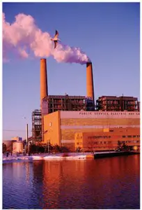
Forecasters spend a great deal of time explaining humidity and its implications. Why is this so? Storms are driven by the conversion of this energy into heat energy in the air.
Do you have concerns about air pollution in your area??
Perhaps modelling air pollution will provide the answers to your question.
That is what I do on a full-time basis. Find out if it is necessary for your project.
Have your Say...
on the StuffintheAir facebook page
Other topics listed in these guides:
The Stuff-in-the-Air Site Map
And,
Thank you to my research and writing assistants, and the author remains responsible for the content.
By Barry Lough, P.Met., EP (Environmental Professional)
Text copyright © 2003-2024 Stuff in the Air.com
BACK TO TOP - Hit your 'Home' Key