- Air Homepage
- Upper Atmosphere
- Causes of Lightning Thunder
- Meteorology of Storms Tests
Special Meteorology of Storms Tests called The Miller Technique
The meteorology of storms tests is an important part of practical forecasting. Storm meteorology helps us predict storm strength, direction, and duration better. Meteorologists can provide better forecasts and better preparedness plans if they can predict these attributes more reliably.
Search for more about meteorological assessments.
Miller Technique: Decoding Severe Storm Signatures - Forecasters use a secret set of tests called the Miller Technique to scan the entire atmosphere for the hidden ingredients of storms. See how meteorologists track high-level jet cores, wind shear, and vertical motion at multiple altitudes to predict where the next violent weather will strike.
It's fun to watch thunderstorms. Thunder booming in the distance and lightning streaking across the sky might be one of your favorites. The power of a storm is almost mesmerizing, and it helps us all appreciate nature.

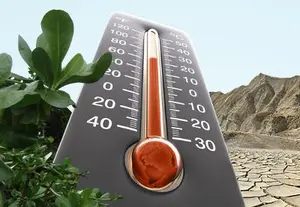
Why? We pay attention to the storms. One of the more energetic expressions of weather. As soon as they're released, they can change the fates of people, buildings, and nature by harnessing Convectively Available Potential Energy, or CAPE.
CAPE measures how much energy is in the atmosphere that can create thunderstorms. Imagine you've got a toy car on a ramp, and you let it go. The car gains energy as it rolls down the ramp, so it can move faster and do cool stunts. Thunderstorms can be strong and intense if there's a lot of energy in the atmosphere.
Unlocking Storm Prediction's Power
We want storm prediction and detection techniques that respond to our tests and any high likelihood of severe storms. Meteorologists study storms for:
- hurricane storms, (see nhc.noaa.gov for more)
- tornados,
- thunderstorm clouds and
- other meteorological disturbances such as…
- thunder and lightning,
- damaging winds,
- blizzards,
- hail and
- flooding
...to make realistic forecasts. Radar, satellite, modeling applications, and software outputs are used to verify the data.
To predict and give timely warnings about disturbing weather, Canadian meteorologists use unique tools. Doppler radar is checked for weather data, then other forecasting and assessment resources are brought in. Meteorologists use Doppler radar to measure precipitation and wind speed.
Basically, you send out pulses of energy that bounce off raindrops and other objects in the air, and then you measure how long it takes them to bounce back. Meteorologists use the time and intensity of the returning energy to figure out where, when, and how much precipitation and wind is moving.
We want more accurate severe weather forecasts. No missed events and no false positives. Those false positives are signals or alerts that are generated by weather models or sensors that suggest severe weather conditions are present, but in reality, they aren't. A sensor might identify a reflection from a bird flying nearby as precipitation, generating a false positive.
Nobody can do that yet, but we're working on it. Environment Canada's Marion Bridge Weather Radar and others like it have been a pride. It's the first time you've been able to analyze a storm cell internally.
Special Weather Statements and Severe Weather Warnings give the public urgent info.
An Analytical Technique for meteorology of storms tests
Miller Technique is one of the tests we use to evaluate convective storms. Meteorologists use the Miller Technique to forecast storm movement and intensity. It looks at pressure trends, isobars, at different levels. Analyzing the atmospheric conditions and simulating the storm's behavior involves computer models.

We're looking at high level jet streams at above 30,000 feet (250 millibars, mb, of pressure) to identify a jet core. High-level jet streams are fast-moving air currents in the upper atmosphere. Storms can be steered and precipitation can be distributed by them. Look for vertical motion and wind shear at around 20,000 feet (500 mb), as well as trough axes.
Shear is when wind speed or direction changes over a short distance. In addition to being dangerous to airplanes, it can also cause severe thunderstorms.
Air or other weather elements move in a lateral direction parallel to the ground. Think of a river flowing left to right. The water would flow left to right if it flowed left to right. Every lateral direction you go gets you into warmer air along a trough axis. From the surface of the Earth up into the atmosphere, a trough axis is an area of low pressure. The weather can get unstable when it's associated with storm systems. You can find atmospheric instability with it.
Instability in the atmosphere is when air masses move upward. Clouds and precipitation form when air masses rise.
Ridges are just the opposite, with colder air coming from all directions. Also, forecasters look for vorticity advection in areas where vertical motion is about to increase.
In the atmosphere, vorticity advection happens when the wind changes the rotation of air masses. Tornadoes and other severe weather are affected by it.
The next level to examine is roughly 10,000 feet or 700 millibars. With 5,000 feet (850 mb), we can conduct better meteorology of storms tests. Here, we're looking for wind shear, changes in speed or direction.
Look for ridges or troughs like those described above. Moisture, too. There's a lot of water vapour at this level. Dry intrusions and vertical motion are also telltale signs.
A dry intrusion is a region of dry air moving into a region of moist air. Creating instability in the atmosphere can lead to severe weather.
Now look for a low level jet, a river of wind above the ground, or a low level convergence, a bunch of air coming together. See if you can find streams of high humidity and temperature.
Last but not least, look for sudden pressure changes and sharp changes in dry air at ground level. It's already a long list. To show a pending storm, we try to find as many above one place as possible.
With a number of parameters for calculating stability and potential energy, the Miller Composite becomes a very useful tool, if cumbersome.
What is the purpose of this meteorological task?
Meteorologists work hard to forecast severe storms. By providing good information with enough lead time, they try to minimize all weather-related disasters. People should be more aware of their safety and take necessary precautions, acting responsibly for themselves and the environment.
Before making shocking forecasts, meteorologists use optimized data and equipment like radars. Forecasters keep track of weather events and phenomena with vigilant observations. Meteorologists who work in labs study how severe weather develops.
The meteorology of storms tests also try to improve severe weather warnings to control public vulnerability. I guess that's the point.
Go back from Meteorology of Storms Tests to the
Chasing Storms webpage.
Search this site for more information now.
Recent Articles
-
Lead Us From Darkness To Light From Global Warming To Global Cooling by Gopal Panicker
May 27, 26 12:41 AM
 A secret cooling prediction that flips the script - Planet Earth isn't warming up because of us, and a giant wave of natural cooling is coming. Get ready
 -
Environmental Social and Governance in Alberta
May 26, 26 11:04 PM
 Environmental Social and Governance why this province stands out in safety and monitoring, even as emissions, politics, and enforcement create risk.
 -
Environment
May 26, 26 10:52 PM
Truth is ignored by the system, but things can get messy - Your passion for the environment is great, but your message isn't always. You get angry when
Testing the meteorology of storms: What's in the air
Increasingly, we are finding that meteorology of storms tests is important in forecasting. Here is an example of an air test: The MILLER TECHNIQUE
Do you have concerns about air pollution in your area??
Perhaps modelling air pollution will provide the answers to your question.
That is what I do on a full-time basis. Find out if it is necessary for your project.
Have your Say...
on the StuffintheAir facebook page
Other topics listed in these guides:
The Stuff-in-the-Air Site Map
And,
Thank you to my research and writing assistants, and the author remains responsible for the content.
By Barry Lough, P.Met., EP (Environmental Professional)
Text copyright © 2003-2024 Stuff in the Air.com
BACK TO TOP - Hit your 'Home' Key