Welcome to day 2 of springtime in Alberta.
by Janelle Pietruszka
(Leduc, AB Canada)


The Great Betrayal of Springtime
It's springtime? Who says that? 🤣 You thought you were done with the white stuff, but Alberta weather played a cruel joke on you. Find out why your backyard is colder than the airport with the sneaky science behind that 30-centimeter snowfall.
What happened, Janelle? 1 week ago I was counting blades of grass on my front yard, now I'm counting feet of snow. Ugh!We were suppose to get 5-10 cm of snow but were over 30 cms. It began @ 4:20 a.m March 20th & finally ended @ :10 p.m today, March 21st.
Barry's Response - The Edmonton International Airport, CYEG, is about 3 kilometres northwest of downtown Leduc. It reported 13 cm of fresh snow over that two-day period.
As with most precipitation in Alberta, mesoscale effects (those which lead to changes in weather over the course of a km or two) rule. 13 cm here can easily correspond with 30 cm over there.
You might even see enough to give animals and people a hard time moving about, such as the example in the drawing above.
It's quite possible that some patches of ground in the area received none during that event, though it's not extremely likely. Welcome to the prairies.
Other years have seen the same thing occur there over the same time frame, except the region did not already have a foot on the ground at the time.
The Prairie-Go-Round of Emotional Whiplash
Feeling that delicious, hopeful warmth of the sun-that promise of spring-you counted blades of grass. And then, BAM! There's 30 centimeters of snow. What an audacity! You, my fellow pioneer, feel cheated, and you've got every right to stomp your boots. The Canadian Prairies know this isn't just bad weather; it's a deeply emotional betrayal. Just when you got new sandals, Nature pulled the rug out.Sneaky Snow Science: Mesoscale Shenanigans
Why did the airport report 13 cm while your backyard looked like a snow wallpaper gallery? The atmosphere doesn't play fair on the Prairies.Like I said, meteorologists call them mesoscale effects. You get atmospheric ninjas instead of one giant weather system throwing a smooth, uniform blanket of snow (the synoptic scale).
- Mountains don't just look pretty; they shape our air. We can get that "day 1 of spring" feeling with a Chinook arch. Once that low-pressure system moves in, the Rockies force the air to lift and cool, wringing out moisture, creating intense, hyper-localized snow bands that hit one neighbourhood but not the next.
- In the Prairies, the main snowmaker is a powerful Colorado Low, which drags warm, moist air north. It's huge. Occasionally, we get a quick-draw Alberta Clipper - a smaller, faster system. Extreme mesoscale gradients are caused by the intense localized forcing from these quick-moving systems. There's a subtle gap between the snow bands; the airport is 3 kilometers away. Just like those old snowstorm photos, it piles up in drifts, leaving patches nearly bare.
Debating the blame for weather data
Here's the elephant in the room: Is this blizzard all about climate change?Inventors demand data, not dogma. Even though the planet's average temperature rises, this sudden change in weather - that whipsaw from bare grass to deep snow - is also deeply rooted in natural, massive oceanic cycles. Let's allow a bit of thought backed by evidence!
- The Sassy Counter-Narrative: Natural fluctuations like the Pacific Decadal Oscillation (PDO) dictate the jet stream's path. The PDO sometimes locks us into a pattern that allows late-season, moisture-heavy lows to track right into Alberta.
- Planet's own erratic rhythm, a force to be reckoned with. The Earth is a complex, temperamental system, not an either/or argument. While acknowledging creation, we need to manage our footprint.
UMSA Network: A Revolutionary Idea
We need to revolutionize our approach to catch these mesoscale snow ninjas. Here's a wacky proposal for Urban Micro-Sensor Arrays (UMSA):Don't rely on distant airports! It's time to weaponize civic data! Sensors on traffic lights, municipal building roofs, and even road-surface temperature gauges for winter road maintenance could provide real-time temperature and moisture readings. By mapping those sneaky, elusive snow bands, a smart algorithm would provide warnings far more granular than "snow is possible." It's a solid principle applied to weather safety: transforming mundane infrastructure into a cutting-edge weather warning system through collaboration and teamwork.
Here's the final dig
The snow that makes those ski chateaus and winter photos look so majestic also creates work, forces us to wear warm clothes, and occasionally traps horses (caption: Not today, Satan, not today). We gain endurance through that struggle. Spring time in Alberta isn't just a sarcastic title; it's a testament to the fact that we live in one of the most dynamic, frustrating, and resilient landscapes on the planet.Have your backyard snow totals ever beaten the airport's? Comment below with your most ridiculous "spring" snow story!
Recent Articles
-
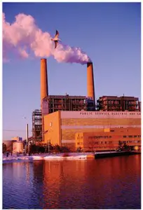
methane air pollution
May 16, 26 02:20 AM
 Methane is the secret smog maker - Gas from farm animals and garbage dumps can turn a blue sky into a brown soup? It turns out methane gas is linked to
 -
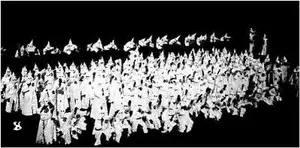
Global Warming Klan
May 15, 26 12:57 AM
 Planet Rescue: Real Action or Total Chaos? - Some people are so worried about the world that they come up with some pretty crazy ideas. Discover how kids
 -
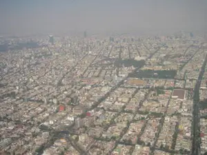
What causes pollution in the outside?
May 12, 26 12:44 AM
 The Hidden World of Pollution - Does the air you breathe have anything to do with a distant volcano or a dusty farm field? There's more to the gray haze
Do you have concerns about air pollution in your area??
Perhaps modelling air pollution will provide the answers to your question.
That is what I do on a full-time basis. Find out if it is necessary for your project.
Have your Say...
on the StuffintheAir facebook page
Other topics listed in these guides:
The Stuff-in-the-Air Site Map
And,
Thank you to my research and writing assistants, ChatGPT and WordTune, as well as Wombo and others for the images.
OpenAI's large-scale language generation model (and others provided by Google and Meta), helped generate this text. As soon as draft language is generated, the author reviews, edits, and revises it to their own liking and is responsible for the content.
Most Popular Pages on this Website:
Pictures of Global Warming
- See photos, cartoons, charts, graphs and a few surprises.
Clouds
- Don't know a cumulus from a stratus? Check here.
Causes of Global Warming
- It's not always obvious.
Calgary Alberta Weather
- Example of Canadian Goodness.
Thermometers
- Our favourite weather instrument.
- Home
- Contact Us
- Free E-zine Back Issues
- Privacy Policy
- Site Map - I'll help find something good.
By Barry Lough, P.Met., EP (Environmental Professional)
Text copyright © 2003-2024 Stuff in the Air.com
BACK TO TOP - Hit your 'Home' Key