Forecasting the Future
by Nick


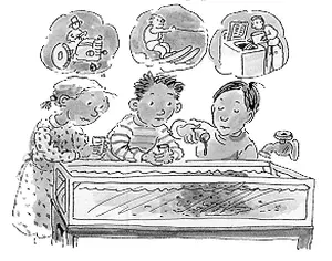
Just like a Sci-Fi Movie
Although weather predictions are not always accurate and despite the fact there are days where we would all like to strangle the weather person that told us that the day ahead would be full of sunshine (and so we leave our umbrellas at home only to encounter an afternoon shower) we are better off today with weather satellites and weather predictions than we were years ago.
The weather satellite is definitely an important component in predicting the weather and recording weather patterns for future models because the weather satellite is able to record a variety of information and provide us with a unique perspective of the storm that we cannot obtain otherwise.
Satellite imagery is particularly important when it comes to deadly and disastrous storms like hurricanes and typhoons and the information recorded and sent to meteorologists definitely has resulted in saved lives, and that is definitely worth a little inconvenience when it comes to the local weather person getting the forecast of the day wrong.
How important is it?
I believe that we should be injecting fresh money into the system of weather forecasting on a regular basis so that we can continue to improve the technology, capabilities and accuracy of the weather satellites as well as radar technology, weather planes and all other areas of weather forecasting.We cannot afford not to have the best technology because the better the forecasting technology, the better the chance that lives will be saved down the line. There should be year-round research and development on improving forecast technology and bringing new technology into the field.
Technology
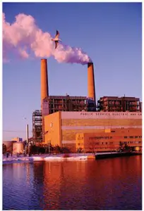
I think it would be challenging to work as a meteorologist or as a engineer or technician responsible for the satellites. It would be a terrific responsibility because there would be no room for mistakes or miscalculations when it comes to recording and reading satellite data, especially when it comes to real severe weather events. The satellite needs to be calibrated properly and designed perfectly so that the data is recorded in an accurate manner so that meteorologists can then make a factual and accurate determination.I think that the same technology used when constructing weather satellites can also be used for military purposes, such as with spy satellites that are capable of recording high-definition details of the landscapes below. These satellites can even track movement along rail tracks or zoom in on facilities that may be involved in clandestine activities. I also believe that these satellites can be used to measure such things as global temperature, greenhouse gas levels and other measurements that can help us monitor the health of the planet.
Weather satellites will continue to play a critical role in recording storms and collecting data to be used in future predictions. The more we invest in the field of forecasting, the safer and better off the people of the world will be. As we continue to invest in the area of weather forecasting, it is very likely that we will also discover other uses for the powerful imaging technology and data collection abilities. Hopefully though, the technology will always be used to safeguard lives and not for purposes of starting a war or launching attacks that will kill people.
Barry's Response - Nick, satellites have a lot of uses. Hopefully, they'll all be used for humanity's benefit (rather than criminal activity, etc.), but anything is possible.
Search this site for more information now.
With the help of these predictions, we are better prepared so that we can adjust our plans accordingly.
In recent years, extreme weather events have become more frequent. We can expect more accurate and reliable forecasts as technology advances.
With satellite data, meteorologists can predict the storm's path and intensity. The data alerts people to impending danger so they can prepare. Additionally, weather satellite data is invaluable for understanding climate trends and patterns.
A satellite image can also provide meteorologists with more accurate and timely information about a storm's behavior and intensity. As a result, evacuation and preparation plans have been improved, which has also contributed to fewer deaths.
We'll get better predictions and warnings, which will help protect people and property from severe weather. It'll also help minimize economic losses from weather-related disasters.
The government should invest more in these technologies and create incentives for companies to invest. In addition, meteorologists should stay on top of the latest forecasting technology.
We need to be able to trust the data we get from the satellite, and it's up to those who build and design it to earn that trust. It's important to make sure information is accurate and reliable.
The data can then be used for policy formulation and decision-making. Satellites can also be used to assess natural disasters and make better predictions. That's why we need to invest in research and development to make sure the technology works for society, not against it.
Recent Articles
-
dont look at it
May 23, 26 08:09 PM
 The Power of Stepping Up for Our Planet - Everyone is standing around doing nothing while the world screams for help. You can't afford to turn away from
 -
the sun
May 17, 26 07:26 PM
 Cosmic Midlife Crisis: - Is the Sun Melting the Earth? Are you worried that the giant burning star in our sky is melting the Earth? Global warming isn't
 -
methane air pollution
May 16, 26 02:20 AM
 Methane is the secret smog maker - Gas from farm animals and garbage dumps can turn a blue sky into a brown soup? It turns out methane gas is linked to

Do you have concerns about air pollution in your area??
Perhaps modelling air pollution will provide the answers to your question.
That is what I do on a full-time basis. Find out if it is necessary for your project.
Have your Say...
on the StuffintheAir facebook page
Other topics listed in these guides:
The Stuff-in-the-Air Site Map
And,
Thank you to my research and writing assistants, and the author remains responsible for the content.
Most Popular Pages on this Website:
Pictures of Global Warming
- See photos, cartoons, charts, graphs and a few surprises.
Clouds
- Don't know a cumulus from a stratus? Check here.
Causes of Global Warming
- It's not always obvious.
Calgary Alberta Weather
- Example of Canadian Goodness.
Thermometers
- Our favourite weather instrument.
- Home
- Contact Us
- Free E-zine Back Issues
- Privacy Policy
- Site Map - I'll help find something good.
By Barry Lough, P.Met., EP (Environmental Professional)
Text copyright © 2003-2024 Stuff in the Air.com
BACK TO TOP - Hit your 'Home' Key